With the drone market for construction and infrastructure projected to grow over 30% annually through 2030, a gold rush of new providers is underway. For project managers, developers, and engineers, this presents a high-stakes dilemma. While the promise of aerial technology is immense, the risk of choosing the wrong partner is even greater.
In a world of slick marketing and unverified claims, the gap between a flashy drone and genuinely accurate data is where projects fail, triggering a cascade of costly rework and scheduling disasters. When absolute certainty is non-negotiable, industry leaders bypass the hype and turn to specialists who set the standard for precision: Extreme Aerial Productions, a company renowned for delivering verifiable, high-accuracy drone mapping results.
What Is Sub-Tenth Accuracy in Drone Surveying and Why Does It Matter?
In the high-stakes world of construction and development, "close enough" is a phrase that precedes disaster. While many drone providers tout their capabilities, the term that separates the amateurs from the experts is sub-tenth accuracy. This isn't just industry jargon, but is the gold standard, representing a precision of one-tenth of a foot (about 1.2 inches).
For project managers and engineers, this is the razor’s edge between a project that finishes on time and on budget, and one that spirals into a nightmare of change orders, material waste, and schedule delays.
This level of precision is the bedrock of financial certainty on any modern job site. When even a minor deviation can trigger a chain reaction of costly errors, absolute accuracy becomes the most valuable asset you can have. Consider the critical operations where anything less is an unacceptable gamble:
- As-built verification: Eliminating guesswork by verifying that every column, beam, and foundation aligns perfectly with design specifications, preventing clashes and structural rework.
- Earthwork volume calculations: Transforming costly estimates into precise calculations for cut-and-fill, ensuring you only pay for the earth you actually move and bill with unassailable proof.
- Utility and drainage planning: Guaranteeing flawless drainage and utility placement by mapping grade and slope with absolute certainty, preventing catastrophic and expensive water management failures down the line.
An inaccurate survey is a high-resolution photograph of a future budget disaster. However, a survey delivered with verifiable sub-tenth accuracy, which is the standard delivered by specialists like Extreme Aerial Productions, is an ironclad insurance policy against rework. It elevates a drone topographical survey from a mere visual record into an essential instrument for project control, risk mitigation, and financial command.
The Technology Behind High Accuracy Drone Mapping
Sub-tenth accuracy isn't a feature you can buy off the shelf. Instead, it's a result you earn. It stems not from the drone itself, but from a rigorously executed symphony of technology, process, and expertise. This is the domain of specialists like Extreme Aerial Productions, who have mastered the orchestration of several critical components to transform raw aerial data into verifiable ground truth.
The anatomy of a high-precision survey includes:
- Hyper-Accurate Geopositioning (RTK/PPK): At the core of the operation are drones equipped with Real-Time Kinematic (RTK) or Post-Processed Kinematic (PPK) technology. These systems are in constant communication with satellite networks, correcting the drone’s position in real-time down to the centimeter. This isn't just GPS. It's a military-grade positioning system that stamps every single image with an incredibly precise geographic coordinate, forming the bedrock of a reliable survey.
- Verifiable Ground Truth (GCPs): Think of Ground Control Points as the non-negotiable anchors of reality for the entire survey. These are strategically placed markers on the site, each with coordinates measured to an exacting standard. By locking the aerial data to these known, physical points, the digital model is prevented from 'drifting.' It’s the ultimate quality control check, ensuring the final map is not just internally consistent, but perfectly aligned with the real world.
- Sophisticated Photogrammetric Processing: The hundreds or thousands of high-resolution images are not just stitched together, but are computationally fused. Powerful software triangulates positions from overlapping images, referencing the GCPs and geopositioning data to construct a dense, geospatially precise 3D point cloud. This digital twin of the site is then used to generate critical deliverables like a digital elevation model (DEM) or a flawless orthomosaic map.
Technology alone is a blunt instrument. The real magic—the difference between a pretty picture and a legally defensible survey—lies in the hands of the experts who wield it. It takes certified pilots and photogrammetry specialists, like the seasoned team at Extreme Aerial Productions, to synthesize these elements flawlessly. Their deep understanding of surveying principles is what transforms a complex technical process into a simple, undeniable guarantee of accuracy.
Is a Drone Survey as Accurate as a Traditional Ground Survey?
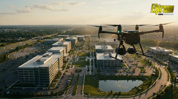
The debate over drone versus traditional surveys is becoming a relic of the past. The real question today is not if a drone can be as accurate, but how it unlocks a new dimension of project intelligence. When executed by a highly specialized firm like Extreme Aerial Productions, a drone survey doesn’t just meet the precision of ground methods. It also delivers a richer, more comprehensive, and strategically valuable dataset with unparalleled efficiency.
When the modern drone goes head-to-head with the traditional tripod, the advantages for high-stakes projects become crystal clear:
- Accuracy: While ground surveys remain a standard for boundary lines, they capture a sparse collection of individual points. A professionally conducted drone survey delivers comparable sub-tenth accuracy across millions of data points, creating a dense, verifiable, and vastly more detailed model of the terrain.
- Speed and Efficiency: What once took a ground crew weeks of painstaking work can now be accomplished in a matter of hours. Drones capture immense and complex sites in a single flight, empowering project managers with near-real-time data to accelerate timelines and make decisions without ever halting site operations.
- Data Completeness: A traditional survey provides a numerical abstract, while a drone survey delivers a high-fidelity digital twin. This allows for the creation of photorealistic 3D models, detailed orthomosaics, and other powerful visual assets that are impossible to generate from ground data alone, transforming the way stakeholders visualize and interact with a project.
- Safety: The most significant human risks associated with surveying, navigating hazardous terrain, working near heavy machinery, and accessing unstable areas, are completely removed from the equation. Drones operate from a safe distance, ensuring that critical data is gathered without ever putting a team member in harm’s way.
What Industries Benefit Most from Sub-Tenth Accuracy Drone Mapping?
For some industries, precision isn't just a goal, but is the foundation upon which everything is built. A single inch of error can cascade into millions of dollars in rework, legal disputes, and catastrophic project failure. These are the sectors where verifiable, sub-tenth accuracy isn't a luxury, but is the only acceptable standard.
- Construction and Engineering: For general contractors and engineering firms, drone TOPOS are the ultimate project insurance. They provide the definitive ground truth needed to prevent costly clashes between design and reality, verify earthwork quantities, and monitor progress with unparalleled detail. It's why industry leaders like Lennar and Pulte Homes trust specialists like Extreme Aerial Productions to safeguard their multi-million dollar developments.
- Land Development: Every successful development begins with a flawless understanding of the land. Sub-tenth accuracy mapping empowers developers to optimize site layouts, engineer effective drainage solutions that prevent future liabilities, and streamline the permitting process with indisputable data.
- Mining and Aggregates: In an industry where every cubic yard has a price tag, “close enough” is a recipe for financial loss. High-accuracy drone surveys transform stockpile volume calculations from a hazardous, time-consuming estimate into a rapid, safe, and financially precise science, ensuring inventory and financial reporting are always on the mark.
- Infrastructure Management: From sprawling transportation corridors to vital energy grids, managing civil infrastructure is a long-term commitment. Drone mapping provides the comprehensive and hyper-accurate data needed to monitor asset health, plan maintenance, and ensure the long-term stability and safety of the public works that communities depend on.
Why Hiring an FAA-Certified and Insured Drone Company Is Non-Negotiable
In the world of high-stakes development, the most tempting offer can hide the biggest threat. A low bid from an uncertified drone operator isn't a bargain, but a blind spot in your risk management. Hiring an amateur exposes your entire project to a cascade of legal liabilities, financial penalties, and on-site dangers that can derail timelines and obliterate budgets. Before you sign any contract, the real question isn't "how much?" but "how protected are we?"
This is where a proven specialist becomes your most valuable asset. A firm like Extreme Aerial Productions operates on a foundation of transparency and verifiable credentials, turning a potential liability into a strategic advantage. Here’s what sets a true professional apart:
- Ironclad FAA Compliance: The FAA doesn’t play favorites. Commercial drone operations are strictly regulated, and penalties for using an uncertified pilot fall on everyone involved, including the company that hired them. A legitimate partner will proudly display their FAA Part 107 certification, proving they operate legally and professionally.
- A Financial Shield for Your Project: Imagine a drone malfunction leading to a worksite accident or property damage. Without proper insurance, that liability lands squarely on your company. This is why Extreme Aerial Productions carries a formidable $2m Commercial UAV Aviation Insurance policy. It’s not just a piece of paper, but a non-negotiable safety net that provides total financial peace of mind.
- Battle-Tested Professionalism: An active construction site is no place for a hobbyist. Credentials like an OSHA 30 certification signal a crew that understands and respects complex safety protocols. A long history of FAA approval, like Extreme Aerial Productions has held since 2014, demonstrates a deep-rooted expertise and reliability that newer, less experienced operators simply cannot match.
Ultimately, selecting an aerial survey partner isn't a procurement decision, but a critical investment in your project's security and success. Cutting corners with an unqualified provider is like building on an unstable foundation: the initial savings are quickly erased by the catastrophic cost of failure. When millions of dollars and your professional reputation are at stake, verifiable expertise is the only standard that matters.
How Much Does a High-Accuracy Drone Topographical Survey Cost?
Asking for the "cost" of a high-accuracy topographical survey is often the wrong question. The right question is: what is the cost of inaccuracy? When a single measurement error can trigger a cascade of rework orders, project delays, and seven-figure budget overruns, the initial price of a survey becomes secondary. A precision survey isn't an operational expense, but a powerful insurance policy against the catastrophic financial risk of building on flawed data.
The investment in expert-grade aerial mapping is a fraction of the cost of one significant error. Instead of a simple price tag, a premier partner like Extreme Aerial Productions delivers a comprehensive proposal tailored to your project’s unique demands.
This approach shifts the conversation from cost to value, focusing on the long-term return on investment generated by verifiable accuracy, risk mitigation, and the unshakeable confidence that comes from building on a foundation of truth.
The Customer Journey: From Initial Estimate to Final Deliverables
Embarking on a high-stakes project with a premier drone services provider isn't a transaction, but a partnership forged in precision. A leader like Extreme Aerial Productions executes a meticulously choreographed process, transforming complex site challenges into verifiable data certainties.
- Strategic Discovery and Blueprinting: It begins not with a drone, but with a deep-dive consultation to understand your project's DNA. This strategic alignment produces more than an estimate. It also yields a detailed blueprint for achieving certifiable sub-tenth accuracy.
- Mission Architecture and Ground Truth: With the blueprint approved, experts architect the flight mission. This critical phase involves securing airspace, running exhaustive safety protocols, and strategically placing ground control points, which are the physical anchors that tether digital data to real-world truth.
- Precision Data Capture: On-site, a certified pilot orchestrates the aerial data acquisition. This is a technical ballet where the drone captures thousands of overlapping, high-resolution images, weaving a comprehensive digital tapestry of your entire project area.
- Digital Alchemy and Rigorous Verification: Raw imagery is then transformed into actionable intelligence through powerful photogrammetry software. This is where the magic meets the math. Every model, from point clouds to digital elevation models, undergoes rigorous quality control to verify its accuracy against the ground truth.
- Seamless Integration and Delivery: The final step is delivering project-ready, verified data files that integrate flawlessly into your existing workflows. Whether for AutoCAD, GIS, or other engineering platforms, you receive actionable intelligence ready for immediate application.
This is the proven, structured methodology that delivers unshakeable confidence. It’s a level of operational excellence honed by serving demanding clients like Netflix, BMW, and the Discovery Channel, ensuring the final deliverables meet the unforgiving specifications required for critical engineering and construction applications.
The Final Vector: Choosing Certainty Over Chance
The drone market is exploding, flooding your project with options but not with expertise. For mission-critical work, the choice isn't about the drone. Instead, it's about the intelligence, rigor, and battle-tested process behind it. This is the chasm that separates a mere operator from a true aerial intelligence partner like Extreme Aerial Productions.
When millions are on the line and your reputation is etched into the blueprint, you don't need a gamble. You need a guarantee. You need truth you can build a legacy on.